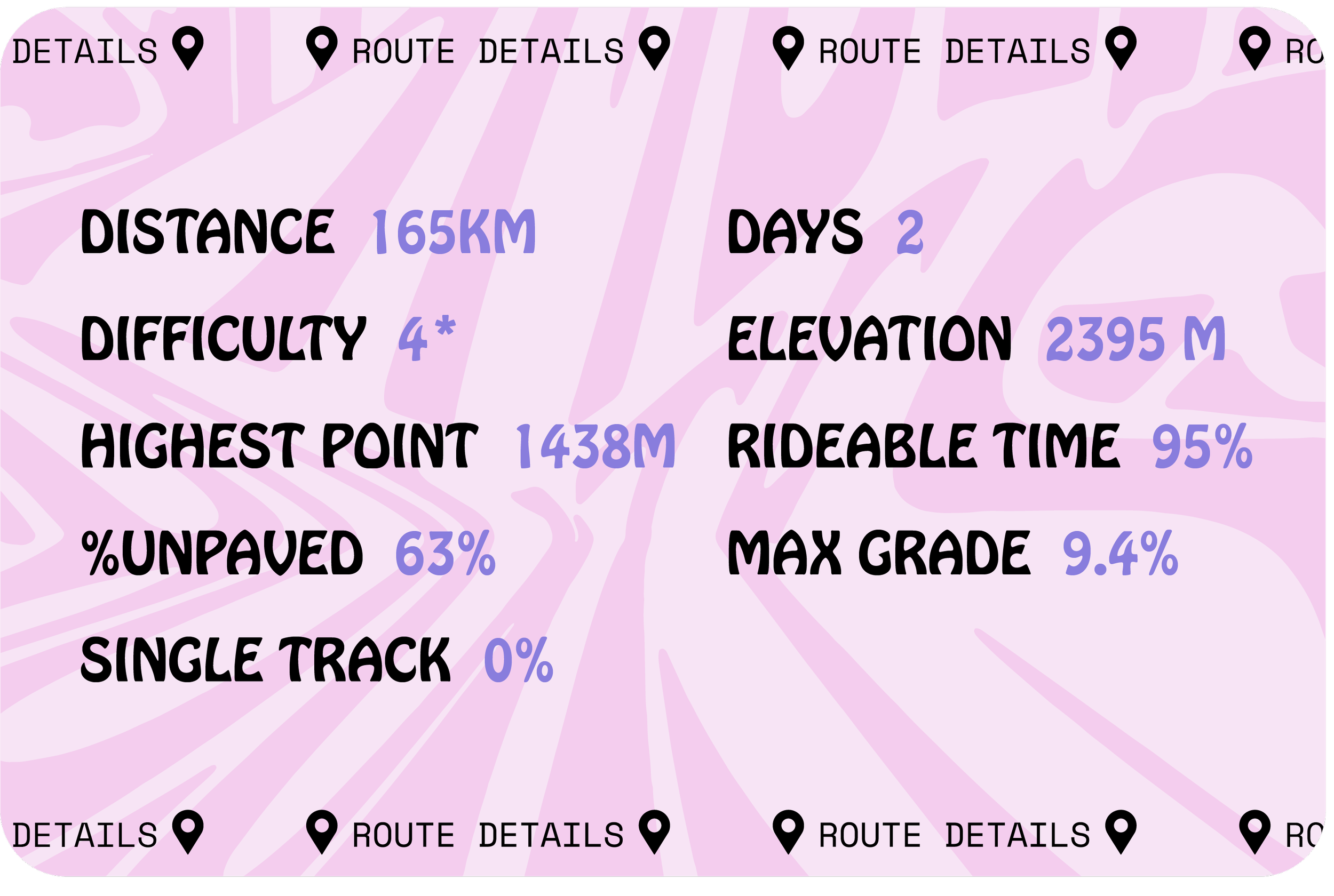
Walcha Overnighter 168 km | 2 Days
These routes are a part of a collection of day and multi-day routes for Walcha Tourism.
This GPX route is free without details. However you can buy the route for $15 and it comes with a well detailed GPX file and an e-booklet containing information and resources to help you get the most of out your ride.
When buying the route you also receive a sticker pack and a discount code for any purchases from Jambz Distro bike packing gear webstore.
If you would like to make a donation towards the route making project you can do so below via a paypal link.
Route Information
-
Great question, you don’t need to! The below Ride With GPS route is free to use.
The 1 - 2 day rides have detail on the free RWGPS file.
The multi day routes have no detail on the free RWGPS file.
If you decide to purchase a route, you receive the following;
A detailed Ride With GPS route which includes camping options, resupply, water sources, more details on terrain and helpful links, info and resources that go with having a great time on a ride.
Suggestions on the best places to eat, drink and stay.
A 20% discount code for Jambz Distro. Your home of bike touring gear.
A sticker pack
Buy buying the route you are also helping to maintain this resource.
The route makers are paid for their work, and they also receive a % of their routes purchases - so your purchase gets to the right places.
-
You can! The upside to each person buying the route is that you all receive the details, there are no excuses for someone to be under prepared.
Each rider receives a 20% discount code and sticker packs sent to them.
The added bonus of including everyone’s details is that we can have a good understanding of how popular the route is.
A goal is to create a calendar of people who are riding the route at any given time. So you can potentially connect with people who are travelling the same time as you.
And finally, supporting the route making project means that it can continue to be a maintained resource.
GPX Link
Route Snapshot
Highlights
The Fruit Shop coffee window in Walcha
Macdonald River swim spot
The long gradual descent into Weabonga
Riamukka State Forest old growth vegetation
The Commercial Hotel in Walcha
The ICONIC! Walcha Overnighter. A 63% gravel, suitable for most abilities, overnight ride that has one smaller day and one large day.
Description
There is a way to divide the days more equally with a change of camping spot, if you want to get the POI’s and finer details of camping, water supply, equipment suggestions you can find this in the paid for version of the route.
Starting in the center of Walcha, after an early coffee at the window of The Fruit Shop and filling your boots with last minute supplies, you leave town westward. What might seem like an unnecessary addition to the route, the small triangular detour through Walcha is purposeful. It is to showcase the old stock yards, built in the 1950’s. Plus it is a nice way to avoid the Oxley highway as long as you can.
Passing by Woolbrook, the only township you will see on this overnighter. Woolbrook, population is a booming 220, hosting a school of 20 children, the AIF Memorial Hall and St John’s church which was built in 1929. The Main North train line finished in 1882 runs through Woolbrook and over the MacDonald River via the heritage listed MacDonald River Railway Bridge...built in 1882.
If the route's first day had a theme, it would be the MacDonald River. The route weaves beside, over and through the 169 km long perennial river that flows mostly north west to meet the Namoi and is a part of the Darling-Murray catchment. Plenty of opportunities for a summer time swim or even a fish if you happened to pack a line.
The second day of this overnighter has less of a distinct theme but using the quiet local roads used only by locals you will travel through rolling farmland to meet Thunderbolt Way and entering the south east of the Walcha council area through the dramatically named Hell Hole Rd. The road is lushly covered in forest. Until it's not; the state forest is well logged and opens up to scarred forestry land - giving you the opportunity to see far into the east and on a clear day views of the Barrington.
On the other side of Riamukka, you will catch a view of the Mummel National Park, which houses some extreme terrain. If you have the nerve to return and give it a go you can find two routes that will help you navigate them.
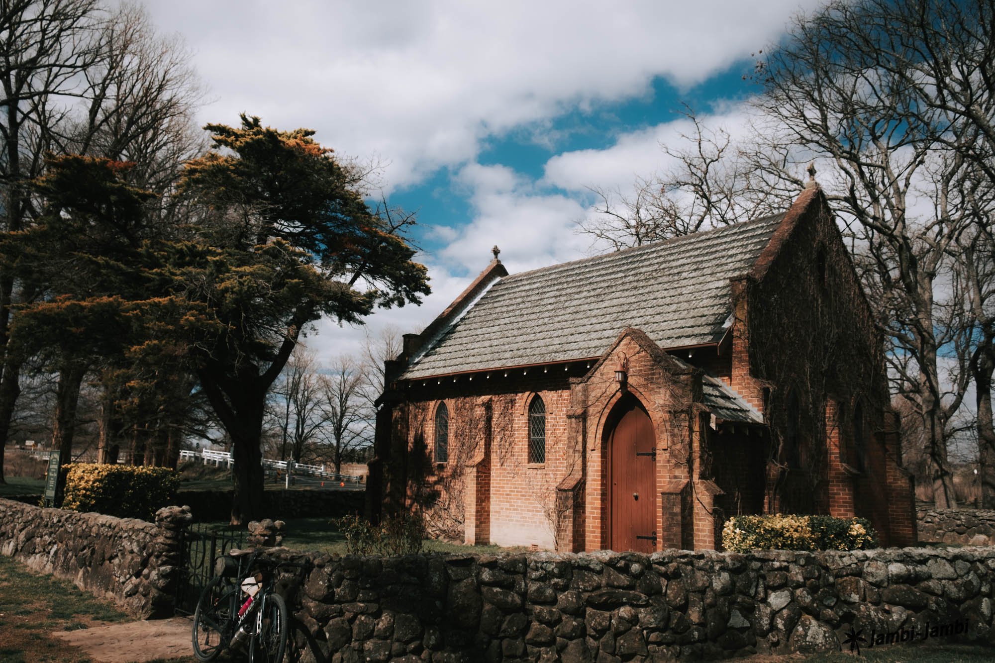
An overnighter is a perfect way to both experience the quiet country around Walcha and have a taste of the town. Walcha is the first and oldest town in New England and has plenty of points of interest. On the way back into Walcha you go past the Old Stone Church, one of many historical buildings in the township. If history is your thing, you can download the historical walk brochure here.
Gallery